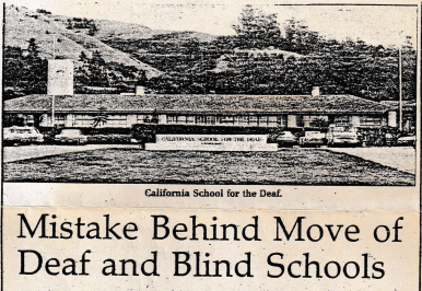
As the University’s land survey is conducted, the results indicate that the earthquake fault underneath the Deaf and Blind school site is inactive. The survey also indicates there is an active fault line running along the edges of the University. The historical maps indicating the the fault lines were created by the U.S. Geological Survey, the maps serve as the only evidence the state determines to relocate the the schools.
Superintendent of Education, Wilson Riles, and Assistant Superintendent of Education, Barry Griffing, indicate the map used as evidence to remove the schools was created by “the world’s foremost authority on the Hayward fault,” Dorothy Radbruch-Hall. In an interview, Radburch-Hall describes the traces on the map as “inferred traces represented through dotted lines,” demonstrating the fault lines are not confirmed but “very indirect” information given by architect Walter Steilberg in 1965.
As Steilberg gave vague information of the fault lines to Radburch-Hall, he was given information on the fault lines from a childhood recollection from UC engineering professor, Joseph LeConte. Although the fault lines are accurately in the area, they have yet to actively move within the past 10,000 to 20,000 years.