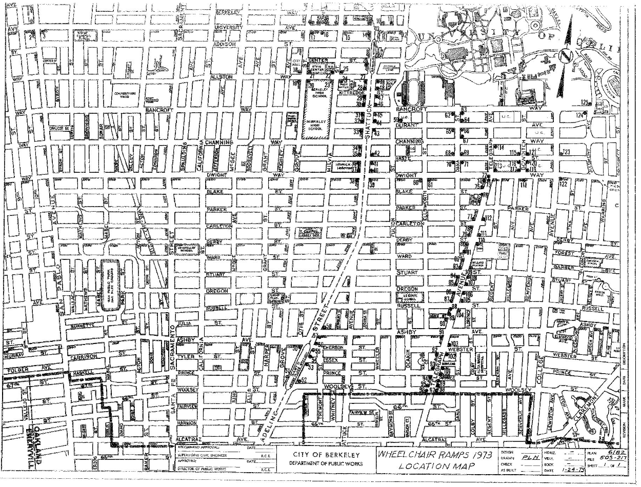
The dots on this map indicate 125 new ramps to be installed by the city of Berkeley.
During the summer of 1972, Ruth Grimes, Hale Zukas, and Eric Dibner surveyed each of the intersections around town and assessed a need for a new ramp at each corner. The larger South Berkeley area—along Telegraph Ave extending from Dwight to Ashby—was by far the largest region selected. (The four blocks between Bancroft and Dwight, close to the UC campus, did not require ramps as this area had been made accessible between 1969-1970 after pressure from the Rolling Quads.)
The ramp plan highlights a wheelchair accessible route along Telegraph Ave all the way to the Oakland border, with new ramps along Shattuck Avenue and the downtown region, and curb ramps close to both downtown Berkeley and Ashby BART stations. Interestingly, there are three ramps at the corner of San Pablo Ave and University, which may have been in close proximity to a bus stop, despite the lack of accessible public transit at the time. There is also a ramp planned on the block of Cowell Hospital, which is often remembered for being an extremely inaccessible building that housed UC Berkeley’s first cohort of physically disabled students.
These new routes enabled people in wheelchairs to safely traverse sidewalks without having to rely on driveways to enter or exit, or to navigate a power wheelchair alongside car traffic in the street. Creating curb cuts enabled folks with disabilities to exercise independence and autonomy over their life. They also drew attention to the ways that disability was not a medical condition, but a function of disabling limitations in the built environment preventing equal access.